Consumer-grade drones currently on the market, in terms of both size and lens quality, are sufficient to meet the general consumer market’s needs. Drone manufacturers have also incorporated panoramic shooting options into their drone photography features. However, due to the limited upward tilt angle of drone cameras, 720º panoramic shots often lack sky coverage. To overcome this, manufacturers use software to automatically fill in the sky portion. The drawback is that since the sky is not captured realistically, the overall effect looks very unnatural—this remains a limitation that drones cannot yet overcome.
The image below shows the original panoramic photo stitched from drone footage. You can see that the software’s sky patch is at best a blur substitute. Additionally, there are several stitching misalignments along the horizon, as well as inconsistencies in lighting and brightness between different photos.
Please use your mouse or finger to move the photo and explore the panoramic image.
The image below shows the result after adjusting the exposure and color of each drone-captured photo, then stitching them together using professional stitching software, followed by sky replacement in Photoshop. Both the color and stitching results are very satisfactory. However, this process involves many additional steps. While drone software’s built-in functions can also stitch panoramic images, the quality of the results is mediocre, requiring more post-processing intervention to achieve satisfactory effects.
Other applications of drone photography include:
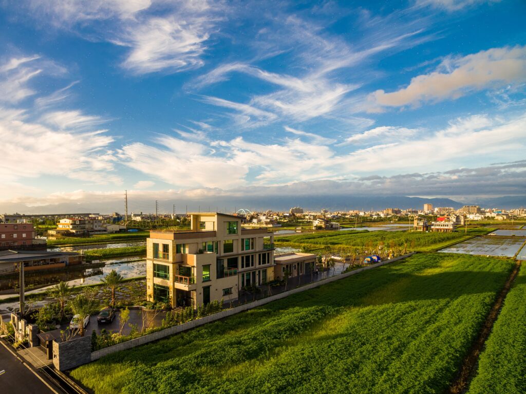
Drone photography primarily provides a tool offering perspectives different from the average person's view, enabling angles that are otherwise inaccessible due to geographical limitations. When special shots are needed, drones capture unique perspectives that enhance the storytelling of the image, as shown in the left picture. Through drone photography, more viewpoints can be presented, allowing viewers to establish stronger spatial relationships and connections with surrounding scenery.
Drone applications add another option to virtual tours, allowing viewers to examine the surrounding environment from different heights and perspectives. However, drone usage is limited by regulations, such as avoiding restricted flight zones set by the Civil Aviation Administration, steering clear of crowded areas, maintaining a distance of at least 30 meters from buildings, and only operating between sunrise and sunset. These restrictions aim to protect public safety and privacy. For general hospitality and real estate needs, drone footage captured within the current regulatory framework—compliant with height restrictions and designated green zones—is sufficient for use.